Sign up for the Family Tree Newsletter Plus, you’ll receive our 10 Essential Genealogy Research Forms PDF as a special thank you!
Get Your Free Genealogy Forms
"*" indicates required fields
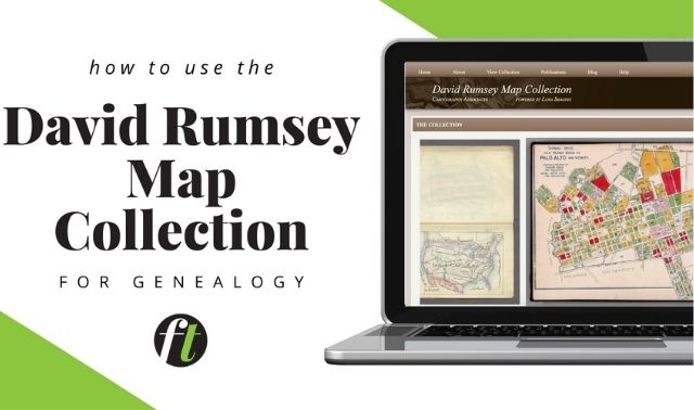
Genealogists love old maps. I could browse the David Rumsey Map Collection for days. But maps are more than cool to look at.
In our Use Historical Maps to Solve Research Problems webinar on Tuesday, April 28, D. Joshua Taylor will show you how to use maps as tools to figure out questions such as migrations, boundary changes, birthplace locations and more. (You might remember Josh as one of the hosts of “Genealogy Roadshow.”)
Here’s how old maps helped me figure out a family migration (albeit a short one) that I didn’t realize had happened:
Awhile ago, I found my great-great-grandfather H.A. Seeger’s May 28, 1879, mortgage record for the property at the corner of Abigail and Pendleton streets in Cincinnati.
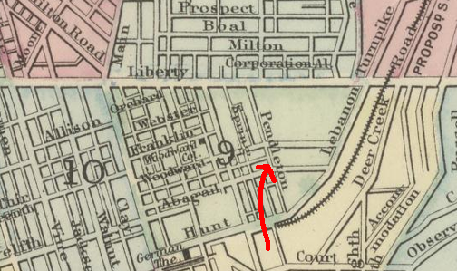
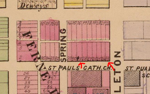
Cincinnati (1884), Plan of Cincinnati and Vicinity by S. Augustus Mitchell, David Rumsey Map Collection
This was, I thought, the corner cigar store his family owned into the 1950s, the one my mom remembers visiting as a child, and which in the early 1980s still bore the outline of its “H.A. Seeger Cigar Manufacturer” sign. Here’s its location on a Sanborn Fire Insurance Map in 1904:
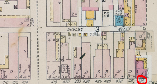
Insurance Maps of Cincinnati (1904), Public Library of Cincinnati and Hamilton County Virtual Library
The street has been renamed and buildings renumbered over the years; my address timeline (taken from old records such as city directories and censuses) includes:
- 112 Abigail in 1879
- 124 Abigail in 1882
- 434 Abigail in 1896
- 434 E. 12th in 1900
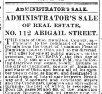
But then I found a Cincinnati Enquirer newspaper notice from June 4, 1890, of an estate sale for that building. It was part of the estate of Joseph Otten, named grantor in that 1879 mortgage along with his wife Agnes.
How could the place be up for sale, when my ancestors lived there at the time and continued to live there later?
The Ottens’ wills offered no explanation, and I couldn’t find evidence that H.A. Seeger purchased the property from Otten’s estate.
But on this 1891 Sanborn Fire Insurance map (published closer to the time of my ancestor’s property purchase), I noted a building numbered 112 six doors down from number 124 on the corner.
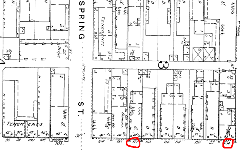
Sanborn Historic Maps (1891), OhioLINK Digital Resource Commons (must be an Ohio resident or have an Ohio public library card)
So my family lived at 112 Abigail from 1879 to 1882, then they moved down the street. This probably occurred to some of you—I guess it goes to show how a family story can give you genealogical blinders. The maps helped me take off my blinders.
As confirmation, I found lot numbers on this 1869 atlas:
Cincinnati part VI embracing 9th & 13th wards (1869), Titus’ Atlas of Hamilton Co., Ohio From Actual Surveys by R.H. Harrison, C.E. … , David Rumsey Map Collection
The map doesn’t have building numbers, but matching it up with the 1891 Sanborn map showsthe building at 112 Abigail is on lot no. 29, the one referenced in the 1879 mortgage record. The cigar store is lot number 23. Now my genealogy to-do list includes looking for a deed for that lot (as well as re-reading the 1879 mortgage to better understand the transaction).
The cigar store has since been combined with the building on the back of the lot, as I learned from the Hamilton County Auditor site and Google Maps, and the front door relocated to the side street.

In the Use Historical Maps to Solve Research Problems webinar, Taylor will cover map resources and tech tools that help you make the most of maps, as well as give examples for solving problems. Learn more about the webinar in Family Tree Shop.
ADVERTISEMENT