Sign up for the Family Tree Newsletter Plus, you’ll receive our 10 Essential Genealogy Research Forms PDF as a special thank you!
Get Your Free Genealogy Forms
"*" indicates required fields
Just what kinds of puzzles can maps and gazetteers help you solve? As you ferret out records that mention your ancestors, you’re bound to need answers to these five questions:
1. How do I find the county where a town is located?
Genealogical sources such as court, land and probate records are usually maintained at the county level, so it’s important to know the county where your ancestors lived. You can identify the county using the RootsWeb county finder at <resources.rootsweb.com/usa> or the USGS Geographic Names Information System (GNIS) <geonames.usgs.gov>.
2. Where can I find out if a town used to be in a different county?
County boundaries have changed over the years, so a town might be located in a different county today than it was in the 19th century. To find records kept at the county level, you have to figure out which county had jurisdiction over the place when your ancestors lived there.
US County Formation Maps 1643-Present <www.genealogyinc.com/maps/uscf.htm> has a large collection of maps showing county boundary changes. Most cover Eastern states. Historical County Lines <jrshelby.com/hcl> links to historical maps showing the evolution of county boundaries in every state.
You also can look to a few offline sources: AniMap Plus software, Map Guide to the U.S. Federal Censuses, 1790-7920 and a new series of volumes called Atlas of Historical County Boundaries.
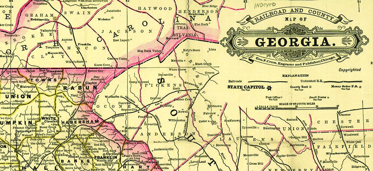
3. A census record says my ancestors lived in a rural township. Where can I find a map that shows townships?
Locating the township on a map lets you identify nearby towns, churches and cemeteries. Some USGenWeb <www.usgenweb.org> county pages show township boundaries.
You’ll probably have to head over to your local library to find township maps for most counties. Two good sources are the Township Atlas of the United States and the Rand McNally Commercial Atlas & Marketing Guide. And each state atlas in the DeLorme Atlas and Gazetteer series has maps showing towns, townships, roads and physical features.
4. What Web sites will help me find a small town?
If the place is in the United States, try the USGS Geographic Names Information System (GNIS) <geonames.usgs.govs>, a database with information on almost 2 million places — including some that no longer exist. And check page 55 to find place-name Web sites for specific states.
For foreign places, start by checking an international mapping site, such as MapQuest <www.mapquest.com> or Multimap.com <www.multimap.com>. National gazetteers and place-name databases have even more comprehensive coverage of place names. Be sure to consider alternate spellings.
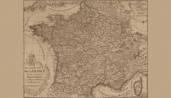
5. Where can I find maps showing parishes in European countries?
Church records are essential to tracing your roots in Europe. To find records on your ancestors, you need to identify the church parish where they lived. Unfortunately, just as townships don’t appear on US road maps, parishes don’t show up on European road maps.
ADVERTISEMENT
Author
A contributing editor for Family Tree Magazine, Rick Crume specializes in online research, genealogy software, DNA testing and British genealogy.