Sign up for the Family Tree Newsletter Plus, you’ll receive our 10 Essential Genealogy Research Forms PDF as a special thank you!
Get Your Free Genealogy Forms
"*" indicates required fields
We often think of the United States as a “melting pot,” but the Old World has its share of ethnic diversity. Centuries of migration have led to complicated—and sometimes, surprising—enclaves in Europe. Ethnic Germans, for example, have lived for centuries along the Danube River, which passes through or along what’s now Germany, Austria, Hungary, Croatia, Serbia, Bulgaria and Romania. Ethnographic maps can help you learn about these diverse communities.
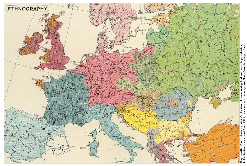
Ethnographic maps capture the geographic distribution of ethnicities. These maps generally color-code the places various groups lived at a particular moment in time. While not perfect, they can give you an idea of the ethnic makeup of your ancestor’s homeland. In addition, they can indicate whether your ancestors were part of an ethnic majority there.
Are Ethnographic Maps Useful?
The usefulness of an ethnographic map in your research partially depends on the map’s level of detail. The map shown here, for example, broadly indicates Croatians, Serbs, Bosnians, Herzegovinians, Montenegrins and Kosovars all in the same shade of yellow, labeled (together with Bulgarians) as “South Slavs.” The more detailed a map is, the more accurate it will be. You may also find ethnographic maps of specific countries or regions (rather than all of Europe) are more accurate.
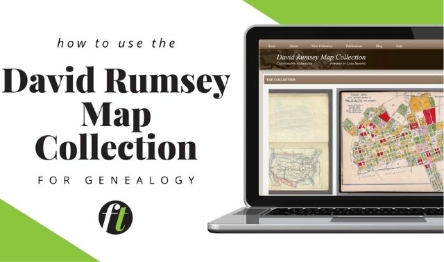
The University of Chicago library website has several 19th-century ethnographic maps. The collection focuses on the colonial world (whose ethnic makeups were just beginning to be studied by Western scholars) as well as areas of Europe and the Middle East—especially where ethnic boundaries conflicted with contemporary political boundaries. The David Rumsey Map Collection also contains several ethnographic maps, including this one, originally published in 1922 as part of an English atlas.
A version of this article appears in the October/November 2016 issue of Family Tree Magazine.
Browse Issues | Subscribe to Magazine
Pin this article for later:
ADVERTISEMENT
Author