Sign up for the Family Tree Newsletter Plus, you’ll receive our 10 Essential Genealogy Research Forms PDF as a special thank you!
Get Your Free Genealogy Forms
"*" indicates required fields
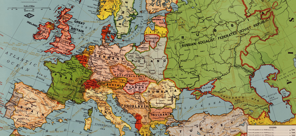
They called it the “war to end all wars.” After four years of fighting, more than eight million people lay dead. And once the mortars stopped firing on Nov. 11, 1918, Europe would never be the same. The Treaty of Versailles the next year put a formal end to the conflict, and this 1921, post-WWI European map shows the borders set by the document. Read on to learn more about what changed as a result of the war.
Empires fall
Many saw World War I as a contest between monarchies and newer forms of government, such as democracy and communism. Indeed, the Russian, German and Austro-Hungarian emperors had all abdicated by the war’s end.
To prevent further conflict, the victorious powers dissolved the Austro-Hungarian Empire and stripped the Germany of some of its lands. Austria-Hungary broke into its constituent parts (the independent states of Austria and Hungary), and the victorious Allies created two new, independent, multiethnic states: Czechoslovakia and Yugoslavia. In addition, Romania gained territory from Austro-Hungarian lands, as did Italy.
Waves of indepedence
World War I also solidified several independence movements. The Treaty of Versailles restored Poland to a sovereign state, reversing the partitions of Poland made in previous centuries. And the Baltic countries (Estonia, Latvia and Lithuania) gained independence from Russia.
Note, too, that Ireland is partitioned in this map. Shortly after the war, most of Ireland became the Irish Free State, an independent country. But six counties in northern Ireland voted to remain in the United Kingdom, creating two separate political entities.
Europe today
The boundaries set by the Treaty of Versailles are foundational. In fact, you might notice Europe doesn’t look too different today than it did 100 years ago. World War II altered German, Russian and Polish borders, and the fall of the Soviet Union spurred successful independence movements in formerly Russian regions such as Ukraine and Belarus. In the late 1980s, Czechoslovakia separated into the Czech Republic (or Czechia) and Slovakia. Likewise, Yugoslavia partitioned into several states during the 1990s, including Serbia, Montenegro and Croatia.
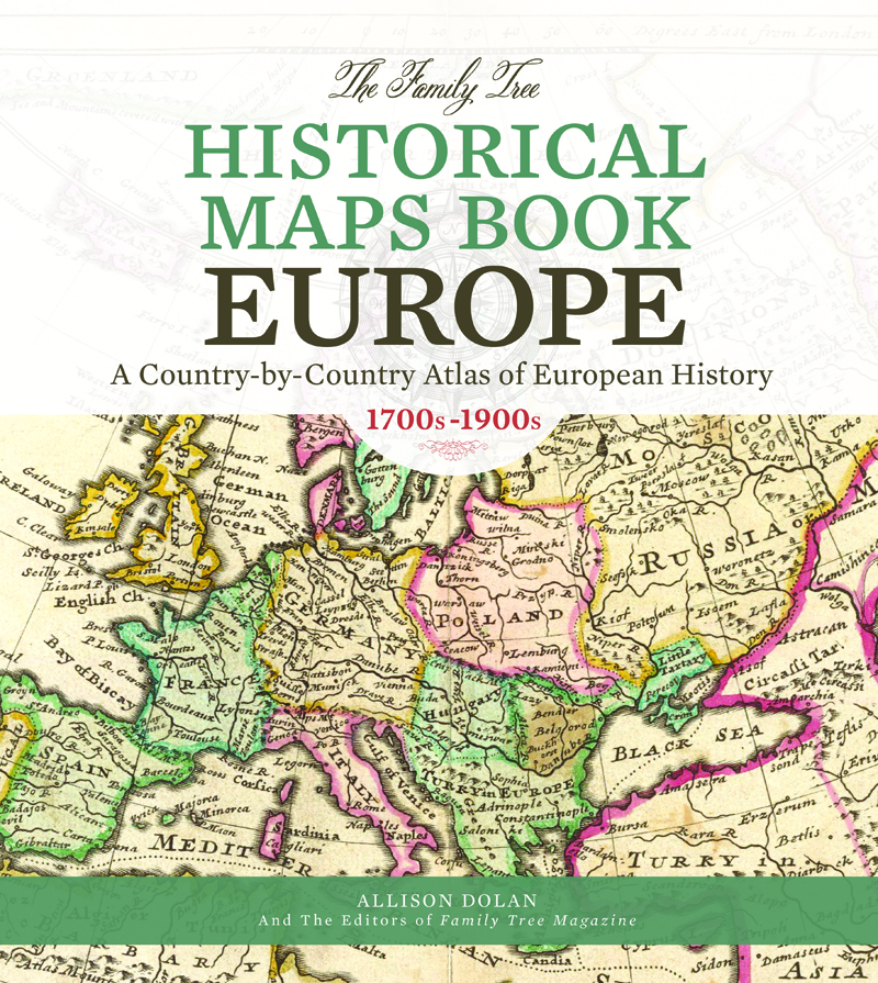
You can find the above map and more excellent European maps from throughout history in The Family Tree Historical Maps Book: Europe. This gorgeous atlas contains maps of every European country from the 1700s to the 1900s, plus historical timelines to help you learn about the most important events in each country’s history.
ADVERTISEMENT